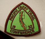
A dinner table conversation at May Lake High Sierra Camp, in September 2000, reminded me of my youthful plans to hike the PCNST, and prompted me to put them into concrete form. As a result, I started a ten-year project to hike the PCNST in bits and pieces in April 2001. My original plan was to hike about 50 miles of trail (100 miles of dayhiking back and forth) per week session, once a month from April through October, with one longer backpacking session each year in August-September, all roughly during the week from first quarter to full moon. Over time, the dreariness of car shuttling, and the slowness of progress hiking back and forth every day, refocused my attention to week-long southbound section hikes, scheduled whenever convenient to encounter the crest of the northbound through-hiker wave. I finally finished in September 2013, a few years late, but I'd hiked all the parts of the PCNST. Then in September 2015 I finished the John Muir Trail by climbing Mt Whitney from Crabtree Meadow. Now I am rehiking the PCNST and its older predecessors, the John Muir Trail, Tahoe-Yosemite Trail, California Riding and Hiking Trail, Oregon Skyline Trail, Cascade Crest Trail, and an important new neighbor, the Tahoe Rim Trail, and new alignments of the PCNST as they are developed. The last big realignment, due to the 2003 Glacier Peak Wilderness flood, finally opened in 2011. The next big one will be the Tejon Ranch reroute if it ever comes to pass. If I ever finished all that agenda, I could do the High Sierra Trail and then the Continental Divide Trail. |
Hiking the PCNST in bits and pieces:
Through-hikers get most of the press and support - but through-hiking is easy - through-hikers don't have to worry about car shuttles. There are certainly more day hikers and section hikers on the PCT than through hikers. In terms of completing the whole trail, through hikers might outnumber section hikers, but nobody keeps track so nobody knows for sure. There aren't that many books or blogs about people's 10 or 20 or 30 year efforts to finally day hike and section hike the whole PCT. The word "blog" is less than 30 years old. So for all the piecewise hikers, I've started to collect useful information for hiking the whole trail in the smallest practical bits and pieces. If you are trying to get as much done as possible in limited vacation time from work, perhaps this information will be useful. But you don't NEED this information - Clinton Clarke and Warren Rogers didn't need no stinkin guidebooks, or gps, or... which was just as well because there weren't any. | |||||||||||||||||||
Astronomy: Data in Pacific Daylight Time (second Sunday in March through first Sunday in November starting 2007): Note that for a particular date, the times for sunrise/sunset and twilight are identical from year to year as far as hikers are concerned, but vary from place to place on the same date. In contrast the moon illumination is the same everywhere on a particular date, but varies from year to year. | |||||||||||||||||||
Geography:
How does latitude trade off against altitude along the PCNST?
What elevations in the
north are comparable to what elevations in the south?
| |||||||||||||||||||
History:
| |||||||||||||||||||
Photos:
The photos are organized by WebMagick into directories of visual index pages of "thumbnail" images. To view an image full size, click on its thumbnail. For further directions, see the navigation page.
|
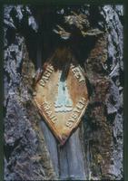
Old PCT marker photo by "Mad Bear" Monte Dodge |
|
My other hiking pages: