We had four hikers in two cars, so we didn't have to make any round trips hiking, though we got very tired of driving to and from Summit Lake and Windigo Pass and Miller Lake.
Aug 5 - 6 hours - driving San Jose to Klamath Falls (Kalamity Falls). We stayed at the Super-8 motel for $63. Hot tub and minimal "toast bar" breakfast at 7:00 am.
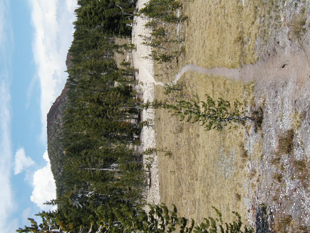
Aug 6 - 13 mi - Crater Lake - Hwy 62 1825.3 to Grouse Hill 1838.6. OR highpoint at 1833.1-7650.
I ate dinner at Molly's 24-hour Truck Stop the night before: the Molly's Trucker Salad special chicken salad with lots of blue cheese dressing. This may have been a mistake; within six hours I was quite ill - but the food poisoning or allergic reaction could have been in response to something eaten earlier; but maybe the "24-hour" refers to how far in advance salads are prepared.
So I was slow getting started, eating a cautious breakfast for four dry pieces of toast. As one of the local real estate firms proudly advertised, "You can't expect too much from Klamath Falls Realty."
To minimize distance from bathrooms, we took this day in three easy pieces; I also link here some pictures from the rim taken while driving through on Sunday August 12, in somewhat different weather:
What's the official PCT route through Crater Lake National Park? At least one sign suggests that the hiker rim route is official, but that sign is so old it lists the total trail mileage as 2638. Certainly the PCTA Data Book is based on the hiker rim route, but the Wilderness Press guide book still lists the lower equestrian route as official.
Since the rim route from the Lightning Spring trailhead picnic area almost all the way to Grouse Hill is an old road, it wouldn't be terribly inappropriate to route the equestrian traffic that way and then down the Lightning Spring trail - but they would miss Red Cone Spring that way. This does affect the location of the Oregon high point (and thus OR/WA highpoint) of the trail - it is either 1833.1-7650 on The Watchman on the hiker rim trail, or 1860.6-7560 on Tipsoo Peak north of Thielsen. In contrast, the Washington high point is 2643.0-7126 on Lakeview Ridge, nearly to Canada, and it may be necessary to go nearly to Donner Pass to outtop The Watchman in California, although several intermediate points come close in Northern California.
In any event the trail signing along the rim route is minimal. Hikers are just supposed to figure it out as they go along, I suppose. This year, it was easy to follow footprints.
We adjourned for the day to Prospect. The newlyweds enjoyed a fine dinner and a night in the historic Zane Grey room ($90) of the historic Prospect Hotel B&B. The rest of us enjoyed an economical meal at the Prospect Cafe next door and a night at Union Creek campground ($10) ten miles north; we breakfasted at Darlene's cafe at the Union Creek resort, which also has some kind of standing as a historical place.
Aug 7 - 13 mi - Road 6010 1890.5 Summit Lake - Windigo Pass 1877.8. Because of our late start so our newlyweds could enjoy a leisurely B&B, we decided to take the next stage out of order and attempted to minimize shuttling time by driving the car to Windigo Pass and the SUV to Summit Lake. By the time we got to Summit Lake, though, I resolved not to attempt to drive my car up there via road 6010, which is just barely a passenger car road, mainly for passenger cars that aren't too valuable nor too heavily laden. I was willing to hike six miles up road 6010 to retrieve the SUV instead.
It may be possible to get to Summit Lake more easily from the west, using current maps of the Umpqua National Forest or Diamond Peak Wilderness.
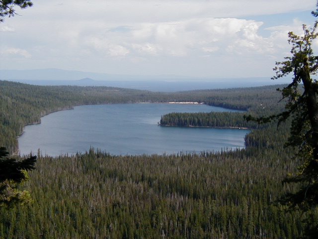
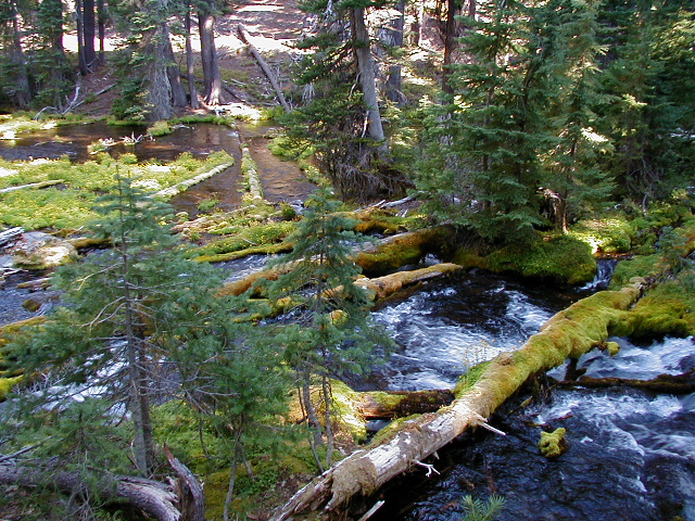
Summit Lake is enormous and looks cold and clear but has the most aggressive mosquitos in section D, and lots of little ponds nearby to breed them. Aside from these, we saw no running water today, and nothing else along the trail either, though the Windigo Lakes are not too far off the trail. The Windigo Pass parking area (like various other trailhead parking lots in the area) was quite a distance from the main road, leaving us wondering whether this was planned to facilitate or inhibit vandalism and breakins. As it was, we encountered neither, from humans or bears.
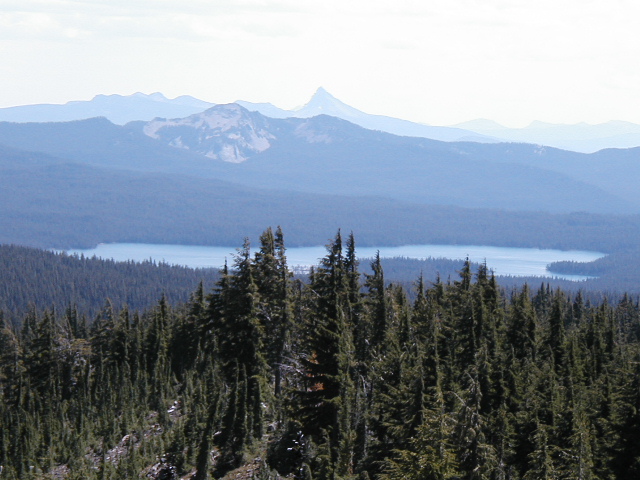
The main thing that was striking and prototypically Oregonian was the miles of viewless forest between scenic spots. The scenery mostly becomes visible either near timberline or in rockslide areas. We found one of the latter for lunch.
By the time we reached our first car at Windigo Pass we thought of a plan to avoid driving it up to Summit Lake on road 6010. We drove around to the Crescent Lake/Odell Lake/Willamette Pass are to look for lodging (our sleeping bags were stuck in the SUV at Summit Lake) and found it at the Willamette Pass Motel, which is currently for sale and doesn't seem to answer the doorbell or phone much, but eventually we rousted out the owner and rented their cute "Chalet" unit, a separate little loft which accommodates 4-6 people and rents for $125. We'd inquired at the Shelter Cove resort on the west end of Odell Lake, but they didn't have any cabins, though they are very solicitous of hikers. Then we wandered off to the Crescent Lake Resort, which is on Crescent Lake, to eat a good dinner, featuring (in my case) pasta primavera on a "butte" of pasta. Later I did a load of laundry at the Motel; the wash was free and the dryer was 75 cents.
After retrieving the SUV and negotiating down road 6010,
we returned to
Shelter Cove Resort,
we enjoyed
hot showers that cost $1.50 for three minutes, and then we spent the night
in their campground.
They also have laundromat machines. Through hikers need to be observant
about trail junctions to get to the resort and back expediently.
Aug 9 - 15 mi - Windigo Pass 1877.8 - Maidu Lake trail 1865.7 to Miller Lake.
This was a good day for northbound through hikers - we met four, including
Paw Bunion from Lightning Spring, this time accompanied by a pair of
angelic blonde identical twins, Monica and Kirsten,
headed for Willamette Pass.
The most reverent comment that inspired
afterward was that, if that through hiker lacked any faith in God,
it would surely be restored now.
The less reverent comments inspired the respectable married woman in our
group to comment that the male members had been out in the woods too long
already (four days) which suggests that she might not want to accompany
us on a through hike any time soon.
The relentless insensitive personal stereotyping on the basis of hair color
may have contributed to those feelings.
The through hikers reported as follows:
Six Horse Spring still had water but was unaesthetic, not worth
the hike off the trail;
Maidu Lake is a pretty good campsite.
Miller Lake
is a lovely underused car campground, with piped water,
flush toilets, and sandy beaches, but it's three miles and 600' below the
trail. It was breezy enough to keep the mosquitos down.
We spent the night in the Featherbed Motel in Chemult, and ate dinner at the Chalet and breakfast at The Wheel, all very reasonably priced establishments.
That night I spent at Diamond Lake. Diamond Lake was suffering a major algae bloom, a hazard particularly of Oregon lakes, and had turned an unattractive color and the fish were said to taste "weedy." As if that weren't enough, a lightning storm that passed through on August 12 started a number of forest fires in the area. Despite all that, the water and the food in the Diamond Lake resort cafe were quite nice. After all that dryness this week, I spent August 12 back at Crater Lake (links above) and at some nearby waterfalls:
I'd planned to try for Stuart Falls just south of Crater Lake National Park but didn't make it.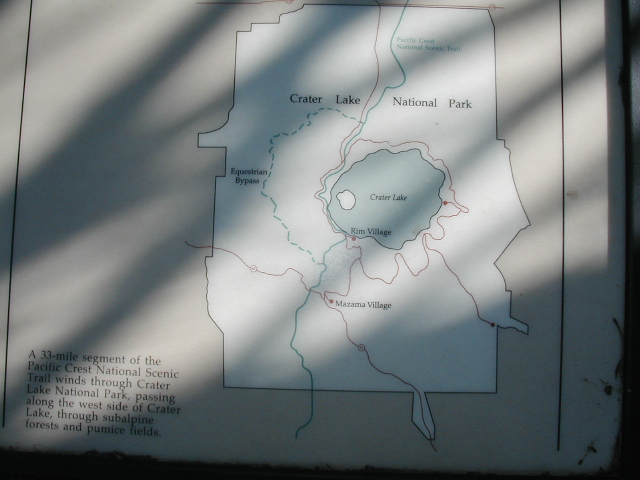